.png)
Urban Planning and Regenerative Gardening
- Mar 13, 2024
- 11 min read
Updated: Apr 20, 2024
Urban planning is an intricate process that shapes the cities and towns we live in, aiming to improve the quality of life for residents while managing growth and resources sustainably. It's a field that combines architecture, public policy, and environmental science to create functional and aesthetically pleasing spaces. With increasing environmental concerns and the push for sustainability, urban planning now also focuses on regenerative practices that restore and revitalize not only the land but also the communities that inhabit them. Here’s a deeper dive into how urban planning is evolving with a sustainable vision.

The Heart of Urban Planning
At its core, urban planning involves much more than drafting the physical layout of city spaces. Planners are visionaries who imagine the future of urban living, integrating green spaces that offer respite from concrete jungles, improve air quality, and enhance biodiversity. They navigate the complexities of urban growth, advocating for spaces that offer both beauty and functionality. Their work ensures that cities are not just habitable but thrive as ecosystems that support both human and environmental health.
Sustainable Urban Development: The Heart of Modern Urban Planning
Green Infrastructure and its impact
Green infrastructure in urban planning refers to a network of natural and semi-natural areas, including green spaces and water systems, integrated within and around urban environments. This approach is increasingly recognized as a pivotal strategy for enhancing urban resilience, sustainability, and the overall quality of life in cities.
Key Aspects of Green Infrastructure
Stormwater Management: Green infrastructure elements like rain gardens, soil restoration, permeable pavements, green roofs, and bioswales are designed to absorb and filter rainwater. This helps reduce runoff, prevents flooding, and can recharge local aquifers, mitigating the impact of heavy rainfall events and urban runoff pollution.
Urban Heat Island Mitigation: Urban areas often experience higher temperatures due to the concentration of buildings, roads, and other infrastructure that absorb and retain heat. Green infrastructure, such as tree canopies and green roofs, can help cool cities by providing shade and releasing moisture into the air through transpiration.
Biodiversity Conservation: Integrating natural habitats and green spaces within urban areas supports biodiversity by providing habitats for various species. This not only includes parks and nature reserves but also smaller green elements like green walls and rooftop gardens that can serve as stepping stones for wildlife connectivity.
Air Quality Improvement: Plants absorb pollutants and carbon dioxide, releasing oxygen back into the atmosphere. Urban forests, street trees, and green belts play a crucial role in improving air quality, thereby contributing to healthier urban environments.
Recreational and Social Spaces: Green infrastructure offers recreational spaces for physical activity, relaxation, and social interaction, contributing to the mental and physical well-being of urban residents. These spaces are essential for community cohesion and individual well-being.
Benefits of Green Infrastructure in Urban Planning
Economic Advantages: Green infrastructure can lead to significant economic benefits, including increased property values, reduced stormwater management costs, and decreased healthcare costs due to improved public health. It also creates job opportunities related to the installation and maintenance of green spaces.
Resilience and Adaptability: By enhancing the natural landscape's ability to manage water and regulate temperatures, green infrastructure makes cities more resilient to climate change impacts, such as extreme weather events, rising temperatures, and flooding.
Enhanced Aesthetic Value: Green spaces, tree-lined streets, and landscaped areas contribute to the aesthetic appeal of urban areas, making cities more attractive places to live, work, and visit. This can boost tourism and attract investment.
Psychological and Health Benefits: Exposure to natural environments has been shown to reduce stress, improve mood, and enhance overall well-being. Urban green spaces are vital for recreational activities, encouraging a more active lifestyle and fostering community interaction.
In summary, green infrastructure plays a critical role in creating sustainable, resilient, and livable urban environments. It bridges the gap between built environments and natural ecosystems, ensuring cities can thrive while providing essential services and benefits to their inhabitants. Urban planners, therefore, are increasingly prioritizing green infrastructure in their development strategies to address environmental challenges and improve the quality of urban life.
Transit-Oriented Development (TOD)
Transit-Oriented Development (TOD) is a planning and design strategy that seeks to create high-density, mixed-use communities centered around transit stations and corridors. The primary goal of TOD is to create compact, walkable, pedestrian-oriented, and bicycle-friendly land use patterns that encourage residents and workers to use public transit as their primary mode of transportation. This approach is seen as a sustainable alternative to sprawling, car-dependent developments, aiming to reduce traffic congestion, improve air quality, and enhance the overall quality of urban life.
Key Elements of TOD
High-Density Development: TOD encourages higher residential and commercial densities near transit stations to maximize access to public transportation and to support a vibrant, active community.
Mixed-Use Development: A mix of residential, retail, office, and recreational spaces within walking distance of transit stations allows people to live, work, shop, and play in close proximity, reducing the need for long commutes.
Pedestrian and Bicycle-Friendly Design: TOD emphasizes the importance of pedestrian and bicycle infrastructure, including safe and attractive sidewalks, bike paths, and crossings, to facilitate non-motorized access to transit and reduce reliance on cars.
Reduced Parking: By promoting the use of public transit and alternative modes of transportation, TOD can afford to reduce parking requirements, freeing up land for more valuable uses and decreasing the urban heat island effect.
Quality Public Spaces: TOD projects often include the development of public spaces, such as plazas, parks, and community centers, to serve as focal points for community activities and social interaction.
Benefits of TOD
Enhanced Mobility and Accessibility: TOD makes it easier for people to access public transit, thereby expanding their reach to employment, education, healthcare, and other essential services without the need for a car.
Economic Development: TOD can stimulate local economies by attracting investment, increasing property values, and supporting local businesses with a steady flow of customers.
Environmental Sustainability: By reducing the need for long car commutes and encouraging the use of public transit, TOD helps lower greenhouse gas emissions and contributes to cleaner air and a healthier environment.
Social Equity: TOD can enhance social equity by providing affordable housing options and improving access to essential services for people of all income levels, particularly those who rely on public transit.
Improved Public Health: The walkable and bikeable environments fostered by TOD encourage physical activity, contributing to improved public health and well-being.
TOD is an integral part of sustainable urban development strategies aimed at creating more livable, equitable, and environmentally friendly cities. By focusing development around public transit hubs, TOD seeks to reshape urban landscapes into more cohesive, inclusive, and accessible communities for current and future generations.
Smart Growth Strategies
Smart growth is a strategic urban planning and development approach aimed at fostering sustainable communities that are environmentally responsible, economically robust, and socially inclusive. It contrasts with traditional, sprawl-based development patterns that often lead to increased automobile dependence, environmental degradation, and social inequity.
Core Principles of Smart Growth
Mixed-Use Development: Smart growth promotes the combination of residential, commercial, and recreational uses in close proximity to reduce the need for long commutes and enhance the quality of life for residents.
Compact Building Design: This principle encourages higher density to preserve open space, natural resources, and farmland, while also making efficient use of land and infrastructure.
Walkable Neighborhoods: Creating pedestrian-friendly communities with safe, comfortable, and attractive walking environments is central to smart growth. This includes well-connected streets, sidewalks, and pedestrian crossings.
Diverse Transportation Options: Smart growth supports a variety of transportation choices, including public transit, biking, and walking, to reduce reliance on personal vehicles and promote sustainable mobility.
Preservation of Open Space and Natural Resources: Protecting and restoring natural landscapes, parks, and agricultural lands is a key aspect of smart growth, contributing to ecological health and providing recreational opportunities.
Strengthened and Directed Toward Existing Communities: Smart growth focuses development towards existing communities to revitalize urban centers, utilize existing infrastructure, and avoid the sprawl that consumes open land.
A Range of Housing Opportunities and Choices: By offering a diversity of housing options, smart growth aims to meet the needs of people at different income levels, family sizes, and stages in life.
Community and Stakeholder Collaboration: Engaging the community and stakeholders in development decisions ensures that growth meets the needs and values of those who live and work in the area.
Benefits of Smart Growth
Reduced Environmental Impact: By promoting higher density and reducing automobile dependency, smart growth strategies help minimize air and water pollution and protect natural habitats.
Economic Efficiency: Compact, mixed-use development can lead to lower infrastructure and transportation costs for both municipalities and residents.
Enhanced Quality of Life: Walkable neighborhoods with access to green spaces, public transit, and local amenities contribute to a higher quality of life and community well-being.
Social Equity: Providing a range of housing options and improving access to transportation and jobs supports social equity by catering to the needs of diverse populations.
Sustainable Mobility: The emphasis on diverse transportation options facilitates sustainable mobility, reducing traffic congestion and greenhouse gas emissions.
Smart growth strategies are about creating sustainable, livable communities that balance the needs of the environment, the economy, and society. By directing growth towards existing centers and prioritizing sustainable practices, smart growth seeks to build cities that not only meet today's needs but are also resilient and adaptable for future generations.
Urban Biodiversity and Ecosystem Services
Urban biodiversity and ecosystem services are critical components of sustainable city planning and development, offering a wide array of benefits that enhance the quality of urban life and the environment. These concepts focus on preserving, restoring, and enhancing biological diversity within urban areas, as well as recognizing and utilizing the essential services that ecosystems provide to urban communities. Understanding these aspects can significantly contribute to creating resilient, healthy, and vibrant cities.
Urban Biodiversity
Urban biodiversity refers to the variety of living organisms, including plants, animals, fungi, and microorganisms, found in urban environments. Despite the challenges posed by urbanization, cities can host a significant amount of biodiversity. Urban green spaces like parks, gardens, green roofs, and water bodies serve as habitats for various species, contributing to the city's ecological richness.
Importance of Urban Biodiversity:
Environmental Resilience: Biodiversity contributes to the resilience of urban environments by supporting ecosystems that can adapt to and recover from adverse conditions, such as climate change and pollution.
Climate Regulation: Urban vegetation plays a crucial role in mitigating the urban heat island effect, reducing temperatures in cities through shading and transpiration.
Air and Water Quality: Plants and green spaces filter pollutants from the air and water, improving environmental health and reducing the burden of disease.
Ecosystem Services
Ecosystem services are the benefits that people obtain from ecosystems. These services are vital for human well-being and include provisioning services (such as food and water), regulating services (such as climate regulation and flood control), supporting services (such as soil formation and nutrient cycling), and cultural services (such as recreational, aesthetic, and educational benefits).
Urban Ecosystem Services:
Health and Well-being: Access to green spaces and natural environments in urban areas has been shown to improve physical and mental health, reduce stress, and enhance overall well-being.
Biodiversity Support: Urban ecosystems provide habitats for wildlife, supporting biodiversity conservation within and around cities.
Economic Benefits: Ecosystem services contribute to the economy by reducing healthcare costs, lowering energy expenses (through natural cooling), and increasing property values.
Strategies for Enhancing Urban Biodiversity and Ecosystem Services
Green Infrastructure: Developing and integrating green infrastructure, such as parks, green roofs, urban forests, and green walls, into urban planning.
Biodiversity Corridors: Creating networks of green spaces that allow species to move and disperse across the urban landscape, enhancing ecological connectivity.
Sustainable Land Use: Implementing land-use practices that preserve natural areas and promote biodiversity within urban settings.
Community Engagement: Encouraging community involvement in the creation and maintenance of green spaces and biodiversity projects.
Policy and Governance: Developing policies that support biodiversity conservation and the enhancement of ecosystem services in urban planning and development.
Urban biodiversity and ecosystem services are interconnected and essential for sustainable urban development. By acknowledging and integrating these concepts into city planning and design, urban areas can become more resilient, livable, and environmentally friendly, offering a better quality of life for current and future generations.
The Role of Technology in Urban Planning
Urban planning has undergone a significant transformation over the centuries, evolving from basic layouts of ancient cities to the complex, technology-driven processes we see today. This evolution reflects changes in societal needs, technological advancements, and our growing understanding of environmental sustainability. Modern urban planning now harnesses a range of technologies to create more efficient, livable, and sustainable urban environments. This article explores the journey of urban planning from its traditional roots to the present day and how technology has reshaped the field, culminating in innovative solutions like regenerative gardening kits that align with contemporary planning goals.
A Brief History
Historically, urban planning focused on practical needs such as defense, transportation, and sanitation. Ancient cities like Babylon and Rome were designed with grids, central marketplaces, and sophisticated water systems. As populations grew, the Industrial Revolution introduced new challenges, including overcrowding and pollution, leading to the garden city movement in the late 19th century, which aimed to blend urban life with nature.
In the 20th century, the car-centric suburban expansion and high-rise developments dominated urban landscapes. However, these approaches often overlooked environmental impact and community connectivity, prompting a shift towards more sustainable and people-centric planning in recent decades.

The Digital Revolution in Urban Planning
Today, technology is at the forefront of urban planning. Digital mapping, Geographic Information Systems (GIS), and Building Information Modeling (BIM) are just a few tools that have transformed the field. Planners can now simulate urban environments, assess the impact of proposed developments, and engage with communities in unprecedented ways.
Data Analytics and Geographic Information Systems (GIS)
GIS, or Geographic Information Systems, is somewhat akin to playing a round of the video game Civilization, but for real cities and environments. In Civilization, you manage and develop expansive territories using maps to strategize the placement of buildings, resources, and infrastructure to ensure the prosperity of your domain. Similarly, GIS allows urban planners to visualize and manage the real-world complexities of urban environments.
With GIS, planners can overlay various data layers—like population density, traffic patterns, green spaces, and utilities—much like overlaying resources, units, and terrain types in Civilization. This comprehensive view supports informed decision-making about where to develop new infrastructure, how to improve traffic flow, where green spaces are needed most, or how to enhance emergency response strategies.
Just as in Civilization, where strategic planning is essential for growth and development, GIS equips urban planners with the insights needed to design sustainable, efficient, and livable cities. By understanding and analyzing the intricate web of urban elements, planners can foresee the impact of their decisions, optimizing for the well-being of the community and the environment—turning the city into a well-oiled machine where every piece works in harmony, much like a successful civilization in the game.

Urban Simulation Models
Urban simulation models are powerful tools that planners use to envision and shape the future of cities and urban environments. Think of them as highly sophisticated video games where city planners can test out different scenarios and strategies to see how they might play out in the real world. These models take advantage of the data and mapping capabilities of Geographic Information Systems (GIS) to create dynamic, detailed simulations of urban areas.
Just as GIS allows for the collection, analysis, and display of geographic data, urban simulation models use this information to predict the effects of urban policies, physical plans, and environmental changes over time. For example, a planner could use these models to simulate the impact of a new public transit system on traffic patterns, housing development, and carbon emissions years into the future.
These models are not just static maps but interactive environments where planners can alter variables (like population growth, zoning laws, or climate change factors) and observe potential outcomes. This helps in making informed decisions that consider long-term sustainability and growth.
Connecting back to the concept of IoT and Smart Cities, urban simulation models could integrate real-time data from sensors and devices scattered throughout the city. This integration allows for even more accurate and up-to-date simulations. For instance, by feeding traffic flow data from street sensors into a simulation model, urban planners can accurately assess and improve traffic management strategies, ultimately leading to smarter, more responsive urban planning that aligns with the goals of creating efficient, livable, and sustainable cities.
Internet of Things (IoT) and Smart Cities
The Internet of Things (IoT) refers to the network of interconnected devices and sensors that collect and exchange data. In urban planning, IoT technologies support the development of smart cities, where data collected from sensors can monitor and manage traffic flow, energy consumption, waste management, and water supply.
The Internet of Things (IoT) and Smart Cities concept might sound complex, but it’s simpler than it seems. Imagine your city as a living, breathing entity, equipped with a nervous system composed of countless sensors and devices. These components aren't just passive; they collect data, communicate with each other, and make decisions to improve the city's efficiency and the quality of life for its inhabitants.
IoT acts as the city's senses and reflexes. It involves embedding everyday objects and infrastructure components with sensors and connectivity, allowing them to collect and exchange data. A simple example would be a parking meter that can communicate its status to a central system to guide drivers to available spaces, reducing traffic congestion.
Smart Cities take this sensory and communication network to orchestrate a harmonious and efficient urban environment. They use the data from IoT devices to streamline city operations and services. Imagine a city that can automatically adjust its street lighting based on current weather conditions and time of day or optimize waste collection routes in real-time based on data from smart trash bins. This not only conserves energy and resources but also makes the city more livable and responsive to its residents' needs.
At the heart of Smart Cities is the goal of making urban areas more sustainable, resilient, and habitable by leveraging technology to solve traditional urban challenges. It's about transforming the urban landscape into a cohesive, intelligent system that enhances public services, reduces environmental footprint, and improves residents' quality of life. Through the innovative use of technology, cities become not just places to live but environments that think, learn, and adapt.
Public Engagement Platforms
Public engagement platforms are digital tools and strategies used by urban planners and city officials to involve the community in decision-making processes. These platforms are like the social media of city planning, designed to gather insights, feedback, and ideas directly from the people who live in the areas being planned or developed. The goal is to make urban planning more democratic, transparent, and inclusive, ensuring that the needs and preferences of the community are considered.
For someone new to urban planning, you can think of these platforms as social media or online forums specifically for civic engagement. Instead of liking photos or commenting on friends' posts, you're giving input on how to make your city a better place to live. These platforms can include surveys, interactive maps, forums for discussion, and tools for visualizing future projects.
A real-world example of this integration is the "Participate Melbourne" platform used by the City of Melbourne, Australia. This online portal invites residents to contribute their thoughts on city planning initiatives through surveys, discussion forums, and interactive maps. Projects open for public input range from climate action plans to designs for public spaces.
In the United States, the city of Boston has a similar initiative called "Imagine Boston 2030." It's a comprehensive plan that used a variety of engagement tools, including online surveys, workshops, and interactive exhibits, to gather public input on the city's future direction. The feedback collected through these platforms helped shape the city's vision for sustainable growth, affordable housing, and improved public transportation.
These examples show how public engagement platforms are vital for fostering a collaborative environment between city officials and residents. By leveraging these tools, urban planners can ensure that the development and policies of urban areas align with the needs and desires of those who live there.
3D Modeling and Virtual Reality
3D modeling and virtual reality (VR) applications in urban planning are like stepping into a future version of a city before it’s built. They take the data and information from Geographic Information Systems (GIS) and urban simulation models and turn them into immersive, three-dimensional experiences. This technology allows urban planners, architects, and the public to visualize changes to the urban environment in a way that’s both detailed and lifelike.
Imagine playing a video game where you design and explore a city. Now, apply that concept to real-life urban planning. That’s essentially what 3D modeling and VR in urban planning are about. Planners can create detailed 3D models of proposed buildings, parks, and entire cityscapes using data from GIS. These models can show how new developments will look from every angle, how they'll fit with existing structures, and how shadows might affect neighboring buildings at different times of day.
Virtual reality takes this a step further by allowing individuals to don VR headsets and "walk" through these 3D models. It's a powerful way for stakeholders to experience the scale and impact of proposed projects firsthand. This immersive experience can help planners identify potential issues and gather feedback from the community in a way that 2D maps and plans can't match.
A practical example of this is Singapore’s Virtual Singapore project. This digital twin of the city uses 3D models and VR to simulate the city’s environment and infrastructure, enabling planners and citizens alike to explore how different policies and plans could affect the city. By integrating data from various sources, including GIS, the project allows for a comprehensive analysis of urban projects before any real-world changes are made.
By combining 3D modeling and VR with the data and predictive capabilities of GIS and urban simulation models, urban planners have a powerful set of tools for designing more efficient, sustainable, and community-friendly urban environments. These technologies not only enhance the planning process but also make it more interactive and accessible, bridging the gap between planners and the communities they serve.
Google Maps in Virtual Reality (VR) is a prime example of how immersive technology can revolutionize our understanding and interaction with urban environments. It takes the concept of 3D modeling and VR applications in urban planning and makes it accessible to the everyday user, effectively embodying the principles of urban simulation and GIS in a user-friendly format.
Sustainable and Resilient Planning
Sustainable and resilient planning are key concepts in urban planning that focus on creating cities and communities capable of withstanding environmental, social, and economic challenges while ensuring the well-being of their inhabitants now and in the future. Building upon the foundational understanding of urban planning, GIS, urban simulation models, and the use of technology like 3D modeling and VR, sustainable and resilient planning integrates these tools and approaches to develop solutions that are both environmentally friendly and robust against unforeseen events.
Sustainability in urban planning refers to the development of urban areas in ways that do not deplete resources or harm ecological systems, ensuring that the needs of the present population are met without compromising the ability of future generations to meet their own needs. This involves the careful consideration of land use, energy consumption, waste management, and transportation systems to minimize environmental impact. For example, promoting green infrastructure like parks and green roofs can help manage stormwater, improve air quality, and enhance urban biodiversity, contributing to a city's sustainability.
Resilient planning, on the other hand, focuses on preparing urban areas to absorb and recover from adverse events, such as natural disasters, climate change impacts, or social and economic upheavals. It involves creating adaptable and flexible urban systems that can respond to change and maintain their essential functions in the face of stress or disruption. This might include designing buildings and infrastructure that can withstand flooding or earthquakes, creating redundant transportation networks that ensure mobility even when one route is compromised, or developing social programs that support communities during economic downturns.
By employing technologies and methodologies discussed previously, urban planners can create detailed simulations and models to test the sustainability and resilience of urban designs. GIS allows for the analysis of environmental data to inform sustainable land use planning, while urban simulation models can predict how different scenarios might impact a city's resilience. VR and 3D modeling further enable planners and stakeholders to visualize and understand the potential effects of their decisions, fostering more informed discussions and choices.
Sustainable and resilient planning aims to create urban environments that are not only conducive to today's lifestyles but are also prepared for tomorrow's challenges. Through the intelligent application of technology and thoughtful consideration of environmental and social factors, urban planners strive to build cities that support healthy, productive, and sustainable lives for all their residents.

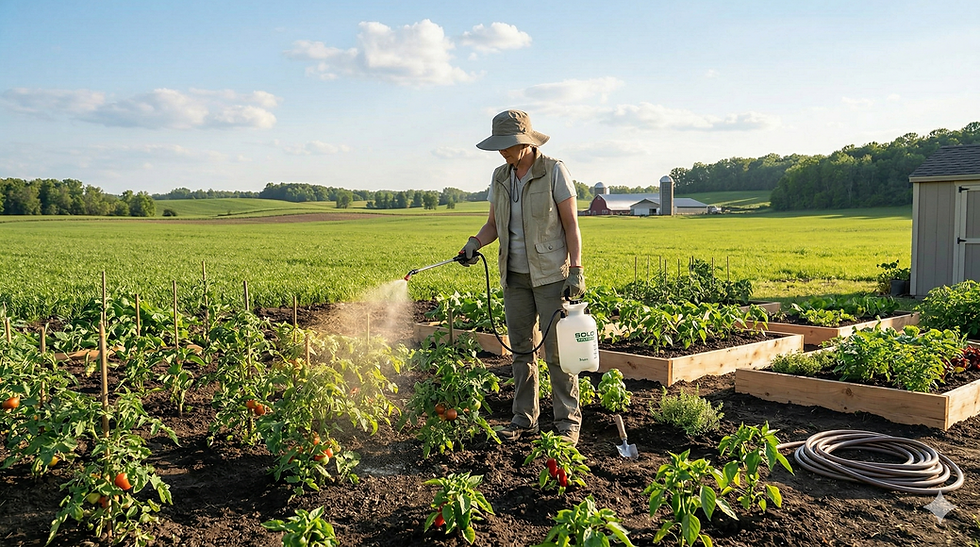
Integrating Green Solutions with Back to Earth Works
Revolutionizing Urban Green Spaces
Our regenerative gardening kit serves as an essential tool for urban planners committed to elevating the ecological health of urban landscapes. Focused on revitalizing urban soils—often found to be degraded and stripped of essential microorganisms—our kit reintroduces a thriving microbiome. This critical intervention not only ensures the health and vitality of plants but also builds soil structure transforming urban areas into resilient, flourishing green spaces, aiding in insulating them from extreme weather.
Key Benefits for Urban Planners and Their Communities
Enhanced Plant Vitality: The components of our kit, including Soil Sanctuary and Earth's Embrace, work in harmony to support and nourish urban vegetation. The result? Visibly lush and biologically vibrant urban areas that contribute to a healthier, more inviting community environment.
Effective Water Conservation: Addressing the challenge of water management in urban settings, our kit significantly improves the soil's ability to retain moisture. This enhancement allows plants to better utilize available water, promoting sustainable growth while also achieving up to a 25% reduction in water consumption as noted by the EPA. This efficiency not only aligns with environmental conservation goals but also offers economic benefits through reduced water costs.
Sustainability at the Core: In the face of escalating environmental concerns, our kit champions the cause for sustainable urban development. By encouraging a balanced soil ecosystem, it reduces dependence on chemical treatments, safeguarding urban biodiversity and ensuring long-lasting, eco-friendly landscapes.
Empowering Community Through Education: The adoption of our kit in urban planning goes beyond physical greening. It provides an invaluable platform for community engagement, educating citizens on the critical role of soil health and sustainable practices. This initiative nurtures a widespread culture of environmental responsibility, inspiring residents to contribute to the regeneration of their surroundings.

Incorporating our regenerative gardening kit into urban landscapes represents a strategic step toward sustainable city living, offering a beacon of hope for environmental rejuvenation.
By leveraging GIS and urban simulation models, planners can strategically identify locations within the city that would benefit most from the application of our kit. 3D modeling and VR technologies can then visualize the potential impact of these revitalized green spaces on the urban landscape, allowing stakeholders to experience the transformation before it occurs and ensuring alignment with the broader goals of sustainable and resilient urban development.
As cities continue to grow and face environmental challenges, the need for sustainable and resilient urban green spaces has never been greater. Our regenerative gardening kit offers a practical and effective tool for revolutionizing these spaces, aligning with the principles of modern urban planning to create healthier, more vibrant, and more resilient communities.
We understand that every urban space has its unique needs and challenges. If you have any questions about how our regenerative gardening kit can be integrated into your urban planning projects or if you're curious about the specifics of how it can benefit your community's green spaces, we're here to help. Press the button below to get in touch with us, and let's start a conversation about bringing sustainable life back to our urban environments.


Comments